
Park map
To help you plan your adventure in the park there are map boards at all major park entrances as well as key junctions throughout the park. Maps refreshed May 2024.
To download a copy of the park map, click here.

Trail information
Click here to check out which Mākara Peak trails are open and closed (and for any alerts). The link will take you to the Trails Wellington website which is the one stop shop for trail information across the Wellington region. As well as trail status, you’ll find all the stats and information you need about each trail at Mākara Peak (and wider afield).
Trailforks
Trailforks is another really useful resource. Not only does Trailforks have trail info for Mākara Peak’s trails, you can see your GPS location on the map to help with navigation, identify the closest emergency location point, view local user-created routes, view trail statuses and reports plus much more.
There’s a free App available on iOS (iPhone, iPad) and Android, and you can take the trail maps with you offline – there’s no need to have mobile coverage to be able to use Trailforks. Never get lost again!

Park signs
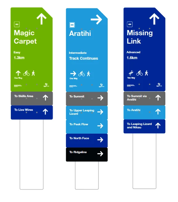
All trails at Mākara Peak have a trail sign at the beginning and at each intersection, with key information to help you find your way around the park.
In addition to being colour coded to allow on-the-fly choices to ensure you don’t accidentally drop into an expert trail, the signs include the direction, trail name, unique trail number, distance, and whether the trail is one or two way.
The rider and walker icons are there to remind everyone that while Mākara Peak is a bike priority network, and walkers have to give way to riders, it’s best if we share and be polite to one another.
Below the main trail sign are the sub signs. Grey signs indicate major landmarks (summit, skills area etc) as well as an indication of which trails are coming up next.
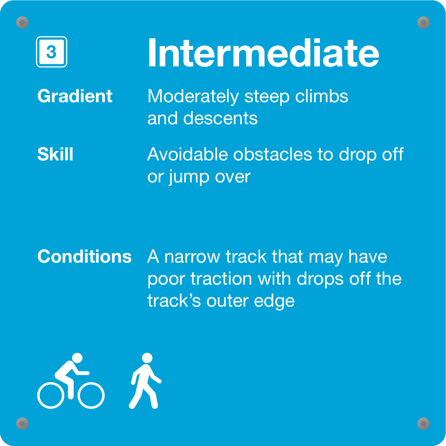
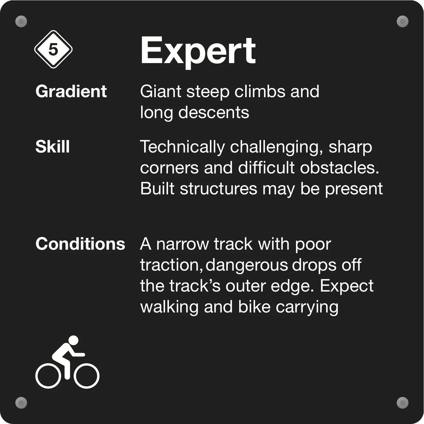
Trail grading
At Mākara Peak trails range from Easy through to Extreme. Always ride within your ability and check signage at the start of each trail.